
Our Services
local government

Local expertise for local projects.

Horizon Archaeology supports local and regional councils with training and the planning and delivery of projects. We provide, clear and accurate advice to aid planning decisions and ensure the best outcomes for heritage and council projects.
Here’s how we can help with your project
•Training in the interpretation of online or GIS-based NZAA data
•High-level archaeological assessments to inform early project planning
•Archaeological survey to identify and record the position of archaeological sites to inform scheme plans
•Reporting to Heritage New Zealand
•Preparation of archaeological assessments to support local government consents or applications for an archaeological authority with Heritage New Zealand Pouhere Taonga
•Archaeological mitigation – monitoring works or pre-construction investigation
•High-quality UAV and GPS survey or archaeological sites
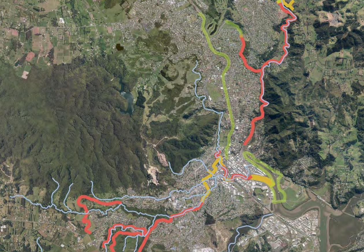
WhangArei District Council Blue/Green Network
Horizon Archaeology has recently completed a predictive exercise for Whangārei District Council, which identified recorded and potential heritage sites across their proposed blue/green network; a collection of dual-use pathways connecting green spaces throughout Whangārei.
This work focused on areas around the streams of Whangārei and identified several areas where unrecorded sites, particularly old settlements and gardens, were likely to be present. Using this new information, together with the locations of previously known sites, we provided Whangārei District Council with a comprehensive risk map for their blue/green network. This map provides clear requirements for heritage management in different zones and ensures project managers are aware of these requirements early to minimize delays and maximize site protection and project delivery.